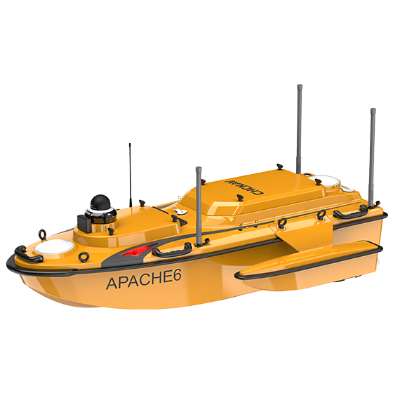
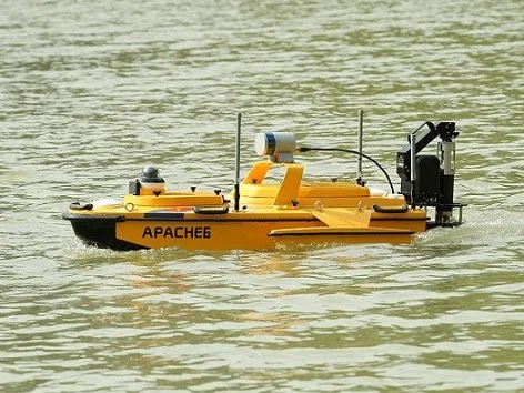
Apache 6
Multibeam Bathymetric Surveys USV
Advanced Unmanned Surface Vehicle (USV) with NORBIT Multibeam Echosounder
-
an innovative, fully integrated solution for 3D bathymetric surveys, positioning of underwater objects, offshore construction, underwater archaeology and wreck salvage
built around a triple-hull vessel and optimized for the Norbit™ multibeam echo sounder series
offers a fully autonomous survey mode, powered by field-proven CHCNAV absolute straight line technology, to follow a predetermined path even in adverse current conditions.
reduces survey time, improves work efficiency and produces high-resolution data to always meet the requirements of the most demanding marine projects.
lightweight for easy deployment, weighting only 15 kg without sensors, which allows for two operators to carry out most of remote deployment
optional terrestrial mapping laser sensor
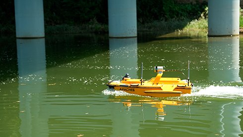
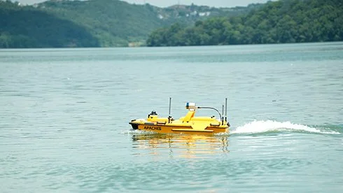
Apache 6 in Action
Perform accurate 3D bathymetric surveys with optional multibeam echosounders and LiDAR scanner. Collect high-resolution data and improve the accuracy of underwater object location and offshore construction.
Multifunctional USV platform
The APACHE 6 tri-hull design and detachable side floats offer a stable position and greater adaptability to ensure optimum stability even in fast currents.
Stable Triple-Hulled Vessel
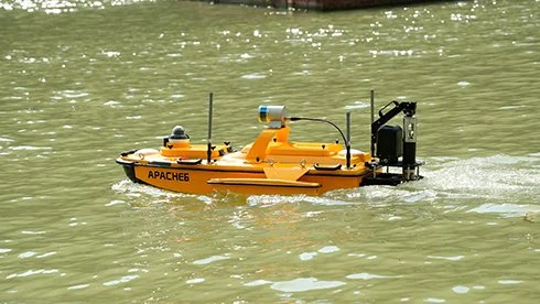
The APACHE 6 supports an optional automatic sound velocity profiler kit, which can be controlled via the remote controller. The kit can be installed or removed in under one minute, providing a complete multibeam echo sounder solution for the USV.
Automated SVP Measurement
The APACHE 6 utilizes intelligent rotating propeller technology to adjust the direction of water flow. It allows the USV to achieve a turning radius of just 2 meters, making it ideal for operation in narrow waterways. It also enhances the efficiency of multibeam echo sounder bathymetric surveys.
Rotating Propellers
The Android remote control provides real-time access to vessel status and survey data, eliminating the need for a computer. Its intuitive interface ensures efficient survey operations, while a multi-link communication enables long-distance data transmission for seamless control of the APACHE 6.
Smart Remote Control

Specifications
Performances
Speed max. : 6 m/s max
Payload capacity : Up to 60 kg
Draft : 7.5 cm
Positioning : Full GNSS + IMU
Echosounder
Type : Single beam, 200 kHz
Range : 0.1 to 200 m
Sensors
Camera : 360° video