CoPre
LiDAR Processing Software
CoPre is a comprehensive LiDAR processing software developed by CHCNAV for efficient and accurate mobile geospatial data processing.
-
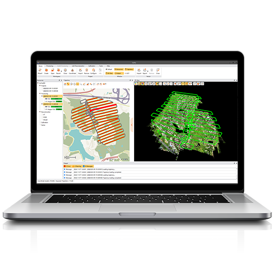
CoPre is a comprehensive LiDAR processing software developed by CHCNAV for efficient and accurate mobile geospatial data processing. It offers a range of functionalities, including trajectory processing, point cloud and image georeferencing, colorization, filtering, and Digital Ortho Model (DOM) generation. CoPre supports all CHCNAV LiDAR systems and enhances the quality and accuracy of post-processing tasks, making it an indispensable tool for geospatial professionals.
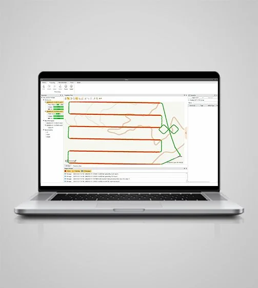
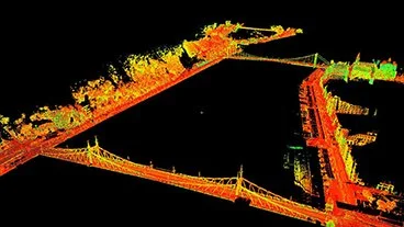
Process trajectory files, LiDAR data, and RGB images efficiently. CoPre uses a proprietary algorithm for accurate and efficient trajectory generation, supporting multiple data sets simultaneously to increase workflow efficiency.
Comprehensive Pre-Processing
Advanced Calibration and Optimization
Enhance data quality with advanced calibration and optimization technologies. CoPre reduces point cloud thickness by 30% compared to similar products, using efficient strip adjustment algorithms and ground control points (GCP) for improved absolute accuracy.
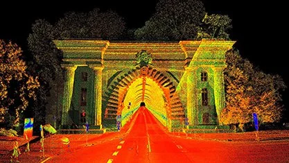
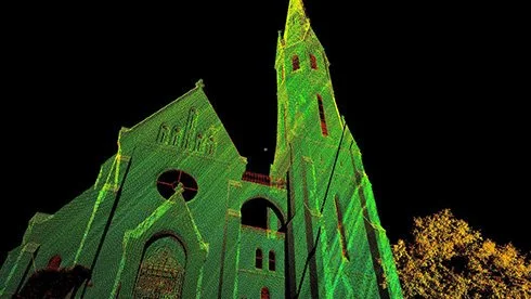
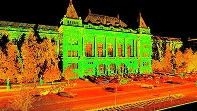
Visualize and colorize massive data sets with powerful options. CoPre’s automatic trajectory slicing and stratification checking quickly detect misalignments, while elevation accuracy is verified using imported control points.
Efficient Data Visualization
Streamline data processing with automated point cloud processing, image georeferencing, point cloud colorization, depth maps, and result output. CoPre's user-friendly interface enhances efficiency and reduces processing time.
Automated Processing Workflow
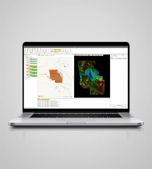
Generate high-quality Digital Ortho Models (DOM) and 3D models. CoPre supports aerial triangulation and combines photos and point clouds to export orthophotos or 3D models quickly, enhancing on-site checks and data accuracy.
Advanced Reconstruction Module
CoPre allows immediate access to raw data from all CHCNAV LiDAR systems. Whether using the compact AlphaAir 10 for UAVs or the AlphaUni 20 for helicopter corridor mapping, CoPre supports seamless data processing, ensuring efficient workflows.
Instant Access to Raw Data
Specifications

System
Operating system : Windows
Languages : English, Chinese
Features
Functions : Generate DOM and 3D models
File formats : Process GNSS, LiDAR, and RGB data