CoProcess
Advanced LiDAR Processing and Point Cloud CAD Software
CoProcess is CHCNAV’s advanced LiDAR and point cloud processing platform, designed to manage large datasets, apply intelligent extraction, and generate professional CAD deliverables directly from point clouds and 3D models.
-
Developed by CHCNAV as part of its integrated LiDAR software ecosystem
Handles massive point cloud datasets efficiently and reliably
Processes field-captured LiDAR data into multiple industry-standard deliverable formats
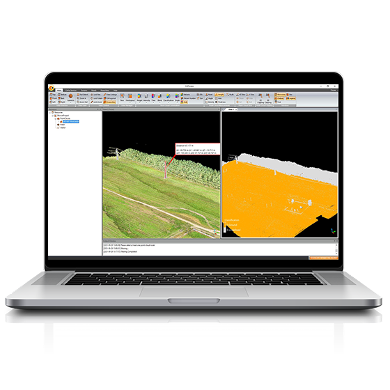
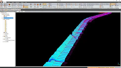
Advanced point cloud management, classification, and visualization tools
Intelligent feature extraction algorithms for faster data interpretation
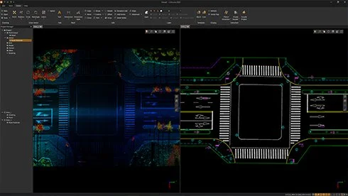
Integrated CAD environment for drafting and design directly from point clouds
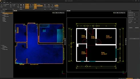
Generates interior and exterior floor plans from point clouds and 3D models
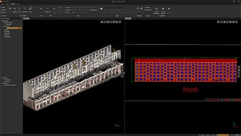
Produces elevation views and structured 2D outputs from 3D datasets
Professional measurement and analysis tools for engineering and infrastructure workflows
Suitable for urban planning, infrastructure development, surveying, and mapping applications
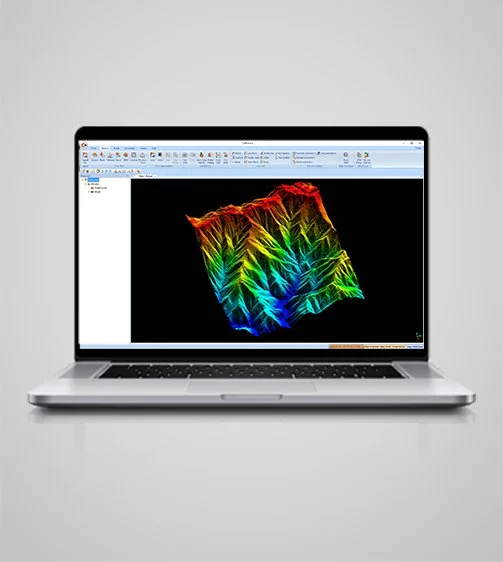
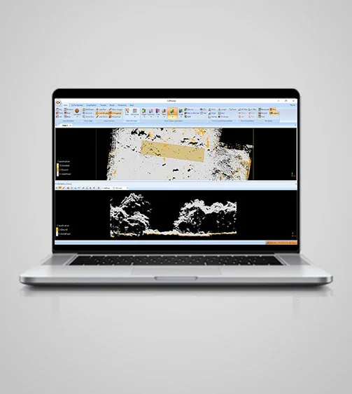
Classify point cloud data into different categories such as ground, vegetation, buildings, roads, and power lines using CHCNAV’s state-of-the-art algorithms. This classification allows for efficient data management and improved analysis.
Massive Data Classification
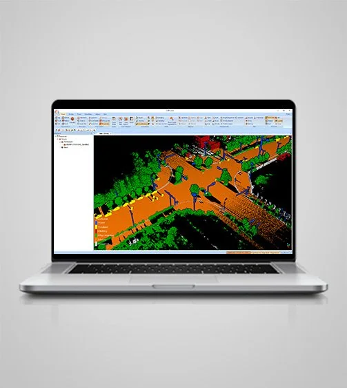
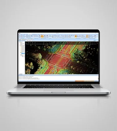
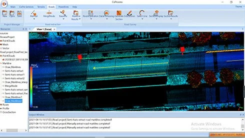
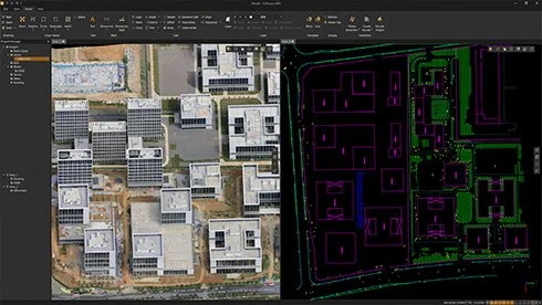
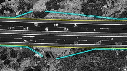
Extract road features automatically and manually and export them in SHP or DXF formats for seamless integration with AutoCAD and ArcGIS. CoProcess also supports the extraction of building contours, doors, and windows.
Powerful Feature Extraction
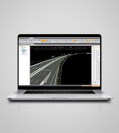
CoProcess 2025 handles 100+ GB point clouds with ease and no batching. Fully DWG-native and CAD-friendly, it supports vertex, orthogonal, edge, and arc modes for one-step contouring. Automated dimensions, rich fills, blocks, and annotation simplify complex drafting and enable direct output.
Faster Drafting
Calculate volumes from point clouds using the grid method and export results in DXF format. Analyze volume differences between successive LiDAR data sets, providing detailed reports for informed decision-making.
Volume Calculation and Analysis
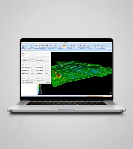
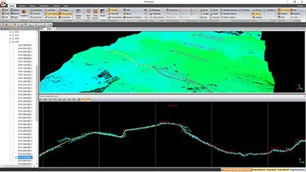
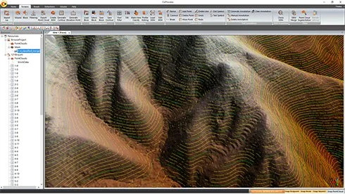
Generate Digital Elevation Models (DEMs) and Digital Surface Models (DSMs) from point cloud data with CoProcess. The software includes specialized algorithms for noise filtering, ground point filtering, and seamless DEM/DSM data export based on the required configuration.
Automatic DEM/DSM Generation
CoProcess offers an intuitive user interface with 7 main modules: Foundation, Terrains, Roads, Extractions, Building Extractions, Volume, and Stockpile. Its customizable UI enhances user experience, making it easy to learn and master, even for new users.
User-Friendly Interface Design
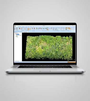
Process trajectory files, LiDAR data, and RGB images efficiently. CoProcess supports multiple data sets simultaneously, increasing workflow efficiency and ensuring accurate data processing.
Comprehensive Pre-Processing
Advanced Reconstruction Module
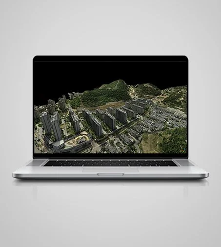
Generate high-quality Digital Ortho Models (DOM) and 3D models quickly. CoProcess supports aerial triangulation and combines photos and point clouds for enhanced on-site checks and data accuracy.
Visualize and colorize massive data sets with powerful options. Automatic trajectory slicing and stratification checking detect misalignments, ensuring comprehensive quality control.
Efficient Data Visualization
CoProcess 2025 loads 50 GB point clouds on 16 GB RAM, with no thinning and on-the-fly slicing. Point clouds can be overlaid with oblique models to correct occlusions, while the Depth Rendering mode enhances dark facades independently of RGB or intensity data ensuring accurate, and complete building contours
Clear View
Smart algorithms support box selection and automatic edge fitting, eliminating manual tracing errors. Plan-Elevation Sync enables fast, accurate elevation views from floor plans. Real-Time Adjacent-Surface Reference ensures geometric consistency between adjacent surfaces, avoiding misalignment and rework.
Precision Drafting
Specifications
System
Operating system : Microsoft Windows 10,11(64-bit)
Languages : English, Chinese
Features
Functions : All-In-One CAD Platform for Point Clouds, Process GNSS, LiDAR, and RGB image data
File formats : CODATA, LAS, HPC,OSGB,DWG, DXF,TIF、TIFF、JPG、JPEG、BMP,PNG,TXT
Modules : Standard, Professional